A long-term access plan could dramatically reshape traffic along the Bogard-Seldon corridor
The plan would reroute roads, close some existing driveways and block some future development access.

What you need to know:
- A long-term road plan under development for the Bogard-Seldon corridor could reroute some roads, close some existing access points, and prevent some future development from having direct access.
- The corridor, which serves more than 10,000 drivers daily, poses significant safety risks due to frequent accidents and bottlenecks. The plan addresses current traffic issues and sets standards for new road connections and private driveways. Officials say these measures will improve safety and traffic flow.
- The plan is open for public comment until Dec. 3. It must be reviewed by the Matanuska-Susitna Borough Planning Commission and approved by the Borough Assembly before taking effect. Hearing dates have not yet been set.
Published: Nov. 27, 2024
Last updated: Dec. 7, 2024
WASILLA - A long-term road plan under development for one of the region's most problematic thoroughfares could reroute some roads, close some existing driveways and potentially block some future development from direct access.
If approved, the Bogard-Seldon Corridor Access Management Plan would help state and borough officials manage traffic flow and guide future road projects. The draft includes dozens of driveway and road closures that would divert traffic to newly constructed connector streets and frontage roads.
The plan, which officials say could take decades to implement, must be reviewed by the Matanuska-Susitna Borough Planning Commission and approved by a vote of the Mat-Su Assembly before it can be used for projects. That review and vote have not yet been scheduled.

A public comment period on the plan is open until Dec. 3. The proposed plan is available online.
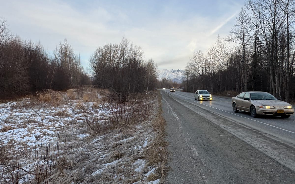
Stretching 13 miles from Palmer to Wasilla, with management and maintenance split between the borough and state depending on the section, the Bogard-Seldon corridor is one of the region's oldest connectors, dating to before statehood.
[Related: Traffic, access concerns loom over gravel pit proposed for a historic Mat-Su dairy site]
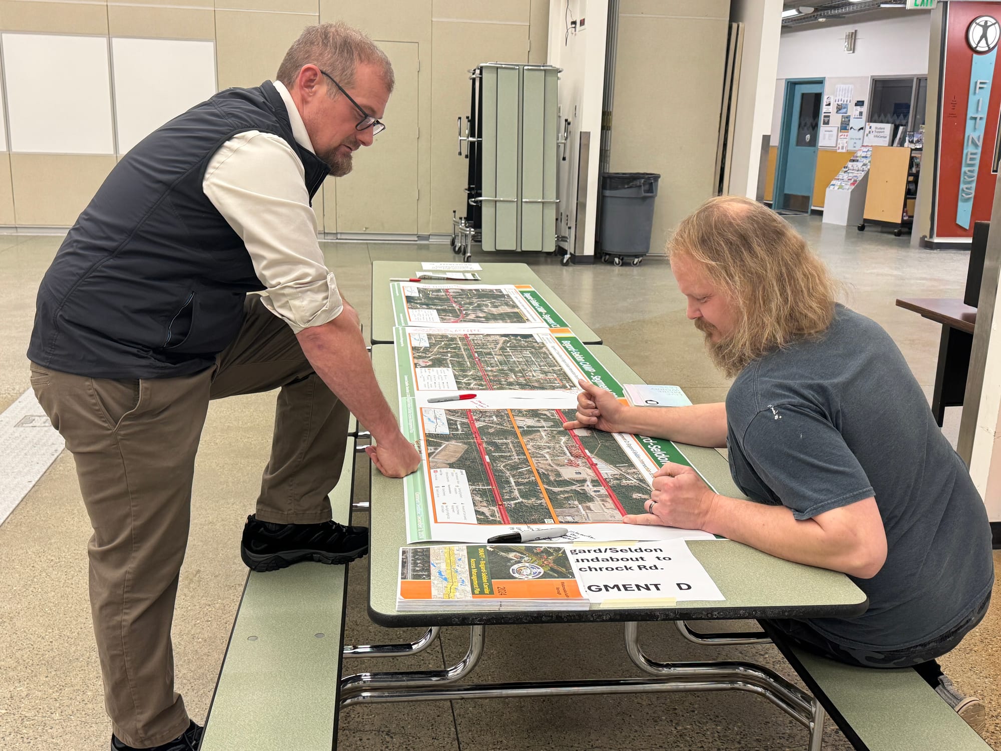
But with more than 10,000 drivers a day passing through some sections, few stoplights, limited lighting and dozens of access points to large subdivisions and businesses, the road has become a major safety and management challenge for local transportation officials. Dozens of accidents are reported each year, and backups on side streets create dangerous bottlenecks, officials said at a recent information meeting.
Mat-Su Sentinel thanks its sponsors. Become one.
The access management plan aims to solve those problems, state and borough planning officials said. The document will guide efforts to prioritize solutions to current traffic problems and review new development proposals. It does not identify any funding for the proposed fixes and projects.
“This will help us determine what the new access would look like,” Alex Strawn, the borough’s planning director, told a joint session of the Planning Commission and Borough Assembly last month. “When we’re doing this, we’re looking at the traveling public as a whole, trying to move traffic along.”
Strawn acknowledged that some of the proposed updates would likely draw significant pushback from residents who don't want their access altered. Those updates include a series of proposed medians that would block left turns on some busy roads, such as the intersection of Stringfield Road near Trunk Road, which leads to a new multifamily housing development, Pioneer Peak Elementary School and the new Mat-Su Central School building.

“There are going to be some people who are not going to be happy with this because their access is going to be affected,” Strawn said.
The plan calls for more than 30 driveway or road closures and detours, mostly between Trunk and Seldon roads and Lucille Street to Church Road. It also recommends that state and borough officials approve new road connections only if they meet certain standards and that they deny approval for most new private driveways.
While planners said the updates should improve overall safety and traffic flow for the thousands of residents who live off the thoroughfare, at least one could have unintended negative consequences, a group of residents told the Mat-Su Assembly this month.
Sign up for Mat-Su Sentinel
Get stories like this one straight to your inbox.
No spam, we promise. Unsubscribe anytime.
A proposed connection from Sams Drive to Charley Drive north of the Bogard-Seldon roundabout is included in the plan as a way to relieve congestion at nearby intersections.
But residents told the Mat-Su Assembly this month that the change could create dangerous encounters between air and road traffic as drivers cross the end of a runway at Anderson Lake on their way to the new cut-through.
“One thing we have to be very careful about is having something where I've heard up to 1,000 vehicles could be going through that a day, and they don't live in an airpark and they don’t understand the rules,” Alaska state Sen. Mike Showers, a resident of the area, told the Assembly during public comment at a Nov. 19 meeting. “I’m hoping that we just look for some alternatives.”

The access management plan is part of a series of ongoing updates focused on the Bogard section of the corridor.
A resurfacing project planned for next year will address deep pavement ruts along the stretch between Trunk and Seldon roads, while a roundabout slated for construction in 2026 is expected to ease congestion at the Engstrom and Bogard intersections.
-- Contact Amy Bushatz at abushatz@matsusentinel.com
This story was updated Nov. 27 to include the correct public comment deadline. The deadline is Dec. 3.


